
Seine flood (January and February 2018)
23,601 hectares of flooded area observed by Copernicus EMS over the mapped sectors
4,253 hectares in Natura 2000 or under regulatory protection
18% of the observed flooded area231 protected animal species recorded within reach in the ten years before the flood
13 animal species threatened on the national Red List, protected or not
birds: by their population in the flood's season


- Communes declared
- 381
- Dates per the orders
- 15 January to 5 February 2018
- Départements
- Seine-et-Marne, Aube, Yvelines, Yonne, Eure and 8 other départements
- Flood type
- river flooding, runoff or mudflow, rising groundwater
- Heaviest rainfall
- 54.6 mm
- in one day (Yonne, 27 January 2018), VILLETHIERRY station · per Météo-France
- 22 January 2018: 0 mm
- 23 January 2018: 0 mm
- 24 January 2018: 0 mm
- 25 January 2018: 0 mm
- 26 January 2018: 0 mm
- 27 January 2018: 54.6 mm
- 28 January 2018: 3 mm
- 29 January 2018: 2.2 mm
- 30 January 2018: 1.6 mm
54.6 mm from 25 to 27 Jan, up to the wettest day
The flood's dates
- Peak discharge
- 2,136 m³/s
- La Seine à Poissy, on 30 January 2018 · provisional Hub'Eau value, it can be revised
- Extent
- flooded area observed by Copernicus EMS over the mapped sectors
- 23,601 ha
Protected species recorded within reach
Observations recorded in the ten years before the flood, some known only to within a few kilometres, up to 10 km, when their published position is blurred or given by grid square. They tell which species were reported there, not what became of each animal.
1,781 species recorded within reach
231 protected animal species among them and 5 protected plants
13 animal species threatened on the national Red List, protected or not (vulnerable, endangered or critically endangered)
180 Birds
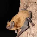
14 Mammals, bats included
12 Amphibians
12 Reptiles
7 Fish, molluscs and crayfish
6 Insects
For birds, the category is the one of their population at the flood's season (breeding, wintering or passage birds): a bird with no dated record within reach in that season in the GBIF data has none, and the breeding category needs at least two dated records in June or July. In the migration season (March, August to October), a bird that neither the passage list nor the wintering list assesses takes its breeding category only if it was recorded at least twice within reach in June or July. The list used is named under each species.
The most notable protected animal species
Species with at least three observations (for a bird, three in the months that give it its category, and no bird without a record at the flood's season), the most threatened first, then the most recorded. An observation is a published record: it can count one or several animals, and the same animal can be noted several times. When their published position is imprecise, blurred or given by grid square, they are said to be "within reach or nearby".
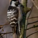
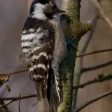
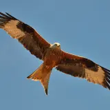
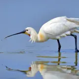
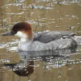
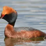
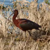
Birds
The observations cover every season: a migrant bird recorded there may have been away on the day of the flood.

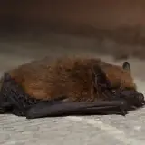
Mammals, bats included
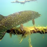
Fish, molluscs and crayfish
For fish, national protection (order of 8 December 1988) covers their eggs and spawning grounds: several are fished legally.
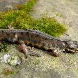
Amphibians

Photos: Wikimedia Commons, each under its own licence (CC BY, CC BY-SA, CC0, public domain). Credit for each photo
In the water's path
Establishments registered today within reach of the flood, at their declared address or at the point Géorisques gives. They were not necessarily there on the day of the flood, and the dataset does not say whether they were flooded. An ICPE-classified farm can also be in the SIRENE register: these counts do not add up.
No ICPE-classified livestock farm located within the flood's reach
Géorisques · ICPE1 livestock business in the SIRENE register based within the flood's reach
SIRENE register · InseeNo veterinary practice based within the flood's reach
SIRENE register · InseeNo animal protection association based within the flood's reach
National register of associationsNo wildlife association based within the flood's reach
National register of associations
The one livestock business in the SIRENE register: 1 horse farm.
A wildlife association is an association whose declared purpose in the national register of associations is the preservation of wildlife: the register does not say whether it runs an authorised care centre. Associations are counted at their declared address: an association or a care centre based outside the area can work across all of it.
Protected areas within reach
Area of each site within reach of the flood, and the share of the site it represents. Natura 2000 and regulatory protection first, then the ZNIEFF.
- Marigny, Superbe, vallée de l'AubeNatura 2000, Birds Directive1,036 ha within reach22.9% of the site
- Bassée et plaines adjacentesNatura 2000, Birds Directive881 ha within reach3.2% of the site
- Seine champenoiseNational nature reserve744 ha within reach30.2% of the site
- Boucles de la MarneNatura 2000, Birds Directive475 ha within reach18.0% of the site
- Barrois et forêt de ClairvauxNatura 2000, Birds Directive231 ha within reach0.6% of the site
- Terrasses alluviales de la SeineNatura 2000, Birds Directive224 ha within reach6.1% of the site
- Lacs de la forêt d'OrientNatura 2000, Birds Directive213 ha within reach0.9% of the site
- Boucles de Moisson, de Guernes et de RosnyNatura 2000, Birds Directive178 ha within reach2.9% of the site
- Prairies, Marais et bois alluviaux de la BasséeNatura 2000, Habitats Directive119 ha within reach14.2% of the site
- Massif forestier d'Epernay et étangs associésNatura 2000, Habitats Directive81 ha within reach2.8% of the site
- Vallée de la Marne de Vitry-le-Francois à EpernayZNIEFF type II (inventoried natural area)5,080 ha within reach38.6% of the site
- Milieux naturels et secondaires de la vallée de la Seine (Bassée Auboise)ZNIEFF type II (inventoried natural area)1,826 ha within reach20.5% of the site
A marsh can be designated twice under Natura 2000, for its birds and for its habitats: the areas overlap and do not add up. A ZNIEFF is a wildlife inventory, with no regulatory protection.
The declared communes
381 communes declared a natural disaster (flood) for this flood, région by région, then département by département.
Île-de-FranceSeine-et-Marne, Yvelines, Essonne, Val-de-Marne, Val-d'Oise, Hauts-de-Seine, Seine-Saint-Denis, Paris
Seine-et-MarneSee the 93 communes
Annet-sur-Marne, Barbey, Beton-Bazoches, Bois-le-Roi, Boissettes, Boissise-le-Roi, Bouleurs, Chalifert, Champagne-sur-Seine, Champs-sur-Marne, Changis-sur-Marne, Charmentray, Chartrettes, Châtenay-sur-Seine, Chelles, Chenoise-Cucharmoy, Chessy, Condé-Sainte-Libiaire, Couilly-Pont-aux-Dames, Crécy-la-Chapelle, Dammarie-les-Lys, Dampmart, Esbly, Fontaine-le-Port, Fublaines, Germigny-l'Évêque, Gravon, Grisy-sur-Seine, Guérard, Héricy, Hermé, Isles-les-Meldeuses, Isles-lès-Villenoy, Jaignes, Jaulnes, Jouarre, Jouy-le-Châtel, La Ferté-sous-Jouarre, La Grande-Paroisse, La Houssaye-en-Brie, La Rochette, La Tombe, Lagny-sur-Marne, Le Mée-sur-Seine, Le Plessis-Feu-Aussoux, Luzancy, Mareuil-lès-Meaux, Mary-sur-Marne, Meaux, Melun, Melz-sur-Seine, Méry-sur-Marne, Misy-sur-Yonne, Montereau-Fault-Yonne, Montévrain, Montry, Moret-Loing-et-Orvanne, Mouy-sur-Seine, Nanteuil-lès-Meaux, Nanteuil-sur-Marne, Neufmoutiers-en-Brie, Noyen-sur-Seine, Othis, Pommeuse, Pomponne, Précy-sur-Marne, Provins, Reuil-en-Brie, Saâcy-sur-Marne, Saint-Augustin, Saint-Cyr-sur-Morin, Saint-Fargeau-Ponthierry, Saint-Germain-sur-Morin, Saint-Jean-les-Deux-Jumeaux, Saint-Mammès, Samois-sur-Seine, Samoreau, Sept-Sorts, Solers, Tancrou, Thomery, Thorigny-sur-Marne, Tournan-en-Brie, Trilbardou, Varennes-sur-Seine, Vaux-le-Pénil, Vernou-la-Celle-sur-Seine, Vignely, Villenauxe-la-Petite, Villiers-sur-Morin, Villiers-sur-Seine, Voulangis, Vulaines-sur-Seine
YvelinesSee the 40 communes
Andrésy, Bennecourt, Bonnières-sur-Seine, Bougival, Carrières-sous-Poissy, Carrières-sur-Seine, Conflans-Sainte-Honorine, Croissy-sur-Seine, Épône, Follainville-Dennemont, Freneuse, Gargenville, Guernes, Hardricourt, Juziers, Le Mesnil-le-Roi, Le Pecq, Le Port-Marly, Les Mureaux, Limay, Limetz-Villez, Louveciennes, Maisons-Laffitte, Maurecourt, Médan, Meulan-en-Yvelines, Mézières-sur-Seine, Mézy-sur-Seine, Moisson, Montesson, Mousseaux-sur-Seine, Notre-Dame-de-la-Mer, Poissy, Porcheville, Rosny-sur-Seine, Sartrouville, Triel-sur-Seine, Vaux-sur-Seine, Vernouillet, Villennes-sur-Seine
EssonneSee the 19 communes
Athis-Mons, Boussy-Saint-Antoine, Brunoy, Corbeil-Essonnes, Crosne, Draveil, Épinay-sous-Sénart, Étiolles, Évry-Courcouronnes, Juvisy-sur-Orge, Le Coudray-Montceaux, Montgeron, Morsang-sur-Seine, Quincy-sous-Sénart, Saintry-sur-Seine, Soisy-sur-Seine, Varennes-Jarcy, Vigneux-sur-Seine, Viry-Châtillon
Val-de-MarneSee the 19 communes
Ablon-sur-Seine, Alfortville, Bry-sur-Marne, Champigny-sur-Marne, Charenton-le-Pont, Chennevières-sur-Marne, Choisy-le-Roi, Créteil, Ivry-sur-Seine, Joinville-le-Pont, Le Perreux-sur-Marne, Maisons-Alfort, Nogent-sur-Marne, Saint-Maur-des-Fossés, Saint-Maurice, Sucy-en-Brie, Villeneuve-le-Roi, Villeneuve-Saint-Georges, Vitry-sur-Seine
Val-d'OiseSee the 16 communes
Argenteuil, Auvers-sur-Oise, Avernes, Bezons, Cergy, Chaumontel, Éragny-sur-Oise, Haute-Isle, Herblay-sur-Seine, Jouy-le-Moutier, La Frette-sur-Seine, La Roche-Guyon, Pontoise, Saint-Ouen-l'Aumône, Vauréal, Vétheuil
Hauts-de-SeineSee the 13 communes
Boulogne-Billancourt, Clichy, Courbevoie, Gennevilliers, Issy-les-Moulineaux, Levallois-Perret, Nanterre, Neuilly-sur-Seine, Puteaux, Rueil-Malmaison, Saint-Cloud, Sèvres, Villeneuve-la-Garenne
Seine-Saint-DenisSee the 6 communes
Épinay-sur-Seine, Gournay-sur-Marne, L'Île-Saint-Denis, Neuilly-Plaisance, Neuilly-sur-Marne, Noisy-le-Grand
ParisSee the commune
Paris
Grand EstAube, Marne
AubeSee the 74 communes
Arcis-sur-Aube, Arsonval, Bar-sur-Aube, Bar-sur-Seine, Barbuise, Bayel, Blignicourt, Bossancourt, Bourguignons, Bréviandes, Buxières-sur-Arce, Celles-sur-Ource, Chappes, Châtres, Clérey, Crancey, Cunfin, Dienville, Dolancourt, Droupt-Saint-Basle, Éguilly-sous-Bois, Essoyes, Étourvy, Gyé-sur-Seine, Jaucourt, Jessains, Juvancourt, La Chapelle-Saint-Luc, La Saulsotte, La Villeneuve-au-Châtelot, Landreville, Le Chêne, Le Mériot, Les Croûtes, Les Riceys, Lesmont, Longchamp-sur-Aujon, Magnicourt, Maizières-la-Grande-Paroisse, Marnay-sur-Seine, Mergey, Merrey-sur-Arce, Méry-sur-Seine, Mussy-sur-Seine, Neuville-sur-Seine, Nogent-sur-Seine, Périgny-la-Rose, Plaines-Saint-Lange, Polisot, Polisy, Pont-Sainte-Marie, Pont-sur-Seine, Proverville, Romilly-sur-Seine, Rouilly-Saint-Loup, Saint-Benoît-sur-Seine, Saint-Hilaire-sous-Romilly, Saint-Julien-les-Villas, Saint-Lyé, Saint-Mesmin, Saint-Parres-aux-Tertres, Saint-Parres-lès-Vaudes, Sainte-Maure, Savières, Spoy, Vallant-Saint-Georges, Vendeuvre-sur-Barse, Verrières, Viâpres-le-Petit, Villacerf, Ville-sous-la-Ferté, Ville-sur-Arce, Villemoyenne, Virey-sous-Bar
MarneSee the 23 communes
Anglure, Arrigny, Athis, Bagneux, Cherville, Chouilly, Conflans-sur-Seine, Coolus, Courthiézy, Courtisols, Dormans, Épernay, Étrepy, Hautvillers, Heiltz-le-Maurupt, Magenta, Marcilly-sur-Seine, Outrepont, Plivot, Saint-Just-Sauvage, Saron-sur-Aube, Tours-sur-Marne, Villeneuve-la-Lionne
NormandieEure, Seine-Maritime
EureSee the 32 communes
Amfreville-sous-les-Monts, Andé, Bouafles, Charleval, Connelles, Criquebeuf-sur-Seine, Gisors, Giverny, Heudebouville, La Roquette, Le Thuit, Le Val d'Hazey, Les Andelys, Les Damps, Les Trois Lacs, Martot, Muids, Notre-Dame-de-l'Isle, Pont-Saint-Pierre, Port-Mort, Porte-de-Seine, Poses, Pressagny-l'Orgueilleux, Saint-Denis-le-Ferment, Saint-Marcel, Saint-Pierre-du-Vauvray, Saint-Pierre-la-Garenne, Vascœuil, Vatteville, Vernon, Vézillon, Villers-sur-le-Roule
Seine-MaritimeSee the 11 communes
Cailly, Caudebec-lès-Elbeuf, Cléon, Elbeuf, Freneuse, Oissel-sur-Seine, Saint-Aubin-lès-Elbeuf, Saint-Léger-du-Bourg-Denis, Sotteville-sous-le-Val, Tourville-la-Rivière, Val-de-Saâne
Bourgogne-Franche-ComtéYonne
YonneSee the 34 communes
Armeau, Baon, Chablis, Champigny, Charmoy, Chaumont, Courlon-sur-Yonne, Courtois-sur-Yonne, Cuy, Deux Rivières, Esnon, Étigny, Gland, Joigny, Laroche-Saint-Cydroine, Migennes, Paron, Pont-sur-Yonne, Rosoy, Saint-Denis-lès-Sens, Saint-Julien-du-Sault, Saint-Privé, Sens, Tanlay, Toucy, Turny, Verlin, Véron, Villecien, Villeneuve-la-Guyard, Villeneuve-sur-Yonne, Villeperrot, Villevallier, Vinneuf
Download this flood's data
In every file of the dataset, this flood carries the identifier EV-20180115-20180205-77.
Recognised and listed


A project labelled by the French StateNational Resilience Day 2026 (Journée nationale de la résilience)

Registered with GBIFDerived dataset, DOI 10.15468/dd.ta4vkx