
Cyclone Chido (December 2024)
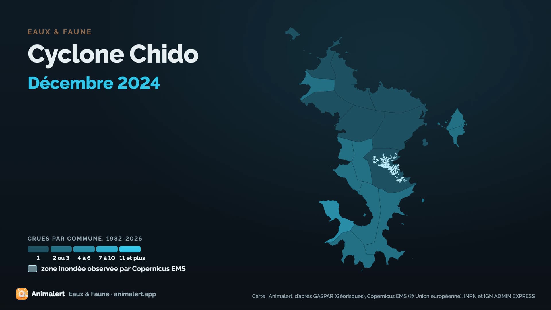
176 hectares of flooded area observed by Copernicus EMS over the mapped sectors
- Communes declared
- 17
- Dates per the orders
- 12 to 14 December 2024
- Départements
- Mayotte
- Flood type
- wave impact, river flooding, runoff or mudflow
- Peak discharge
- 0 m³/s
- Le Mro wa Mouhogoni à Bandraboua, Mouhogoni, on 12 December 2024 · provisional Hub'Eau value, it can be revised
- Extent
- flooded area observed by Copernicus EMS over the mapped sectors
- 176 ha
Protected species recorded within reach
Observations recorded in the ten years before the flood, some known only to within a few kilometres, up to 10 km, when their published position is blurred or given by grid square. They tell which species were reported there, not what became of each animal.
3 species recorded within reach
0 protected animal species among them
In the water's path
Establishments registered today within reach of the flood, at their declared address or at the point Géorisques gives. They were not necessarily there on the day of the flood, and the dataset does not say whether they were flooded. An ICPE-classified farm can also be in the SIRENE register: these counts do not add up.
No ICPE-classified livestock farm located within the flood's reach
Géorisques · ICPENo livestock business in the SIRENE register based within the flood's reach
SIRENE register · InseeNo veterinary practice based within the flood's reach
SIRENE register · InseeNo animal protection association based within the flood's reach
National register of associationsNo wildlife association based within the flood's reach
National register of associations
A wildlife association is an association whose declared purpose in the national register of associations is the preservation of wildlife: the register does not say whether it runs an authorised care centre. Associations are counted at their declared address: an association or a care centre based outside the area can work across all of it.
The declared communes
17 communes declared a natural disaster (flood) for this flood, département by département.
MayotteSee the 17 communes
Acoua, Bandraboua, Bandrele, Bouéni, Chiconi, Chirongui, Dembeni, Dzaoudzi, Kani-Kéli, Koungou, M'Tsangamouji, Mamoudzou, Mtsamboro, Ouangani, Pamandzi, Sada, Tsingoni
Download this flood's data
In every file of the dataset, this flood carries the identifier EV-20241212-20241214-976.
Recognised and listed


A project labelled by the French StateNational Resilience Day 2026 (Journée nationale de la résilience)

Registered with GBIFDerived dataset, DOI 10.15468/dd.ta4vkx