
Floods, Ardèche and 6 other départements, November 2014
206 communes under a natural disaster declaration (flood)
289 protected animal species recorded in the declared communes in the ten years before the flood
19 animal species threatened on the national Red List, protected or not
birds: by their population in the flood's season
- Dates per the orders
- 2 to 6 November 2014
- Départements
- Ardèche, Saône-et-Loire, Côte-d'Or, Isère, Rhône and 2 other départements
- Flood type
- river flooding, runoff or mudflow
- Heaviest rainfall
- 356.4 mm
- in one day (Ardèche, 3 November 2014), MAYRES station · per Météo-France
- 29 October 2014: 0.3 mm
- 30 October 2014: 0.2 mm
- 31 October 2014: 0.4 mm
- 1 November 2014: 0.1 mm
- 2 November 2014: 12 mm
- 3 November 2014: 356.4 mm
- 4 November 2014: 40.8 mm
- 5 November 2014: 0 mm
- 6 November 2014: 0 mm
368.5 mm from 1 to 3 Nov, up to the wettest day
The flood's dates
- Peak discharge
- 1,036 m³/s
- L'Ardèche à Ucel, on 3 November 2014 · per Hub'Eau
- Extent
- communes under a natural disaster declaration (flood)
Protected species recorded in the declared communes
Observations recorded in the ten years before the flood, some known only to within a few kilometres, up to 10 km, when their published position is blurred or given by grid square. They tell which species were reported there, not what became of each animal.
5,557 species recorded in the declared communes
289 protected animal species among them and 32 protected plants
19 animal species threatened on the national Red List, protected or not (vulnerable, endangered or critically endangered)
182 Birds
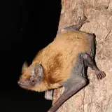
39 Mammals, bats included
20 Insects
19 Reptiles
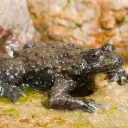
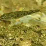
17 Amphibians
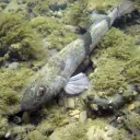
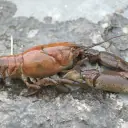
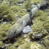
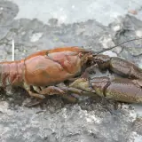
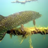
12 Fish, molluscs and crayfish
For birds, the category is the one of their population at the flood's season (breeding, wintering or passage birds): a bird with no dated record in the declared communes in that season in the GBIF data has none, and the breeding category needs at least two dated records in June or July. In the migration season (March, August to October), a bird that neither the passage list nor the wintering list assesses takes its breeding category only if it was recorded at least twice in the declared communes in June or July. The list used is named under each species.
The most notable protected animal species
Species with at least three observations (for a bird, three in the months that give it its category, and no bird without a record at the flood's season), the most threatened first, then the most recorded. An observation is a published record: it can count one or several animals, and the same animal can be noted several times. When their published position is imprecise, blurred or given by grid square, they are said to be "in the communes or nearby".
Fish, molluscs and crayfish
For fish, national protection (order of 8 December 1988) covers their eggs and spawning grounds: several are fished legally.
Mammals, bats included
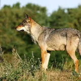
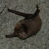
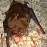
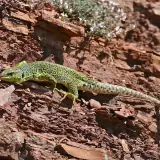
Reptiles
Amphibians
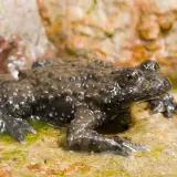
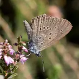
Photos: Wikimedia Commons, each under its own licence (CC BY, CC BY-SA, CC0, public domain). Credit for each photo
In the water's path
Establishments registered today in the communes declared for this flood, taken whole, at their declared address or at the point Géorisques gives. They were not necessarily there on the day of the flood, and the dataset does not say whether they were flooded. An ICPE-classified farm can also be in the SIRENE register: these counts do not add up.
2 ICPE-classified livestock farms located in the declared communes
Géorisques · ICPE1,078 livestock businesses in the SIRENE register based in the declared communes
SIRENE register · Insee82 veterinary practices based in the declared communes
SIRENE register · Insee41 animal protection associations based in the declared communes
National register of associations11 wildlife associations based in the declared communes
National register of associations
Of the 1,078 livestock businesses in the SIRENE register: 576 cattle, sheep, goat or pig farms, 97 horse farms, 55 poultry farms and 350 farms of other animals.
A wildlife association is an association whose declared purpose in the national register of associations is the preservation of wildlife: the register does not say whether it runs an authorised care centre.
Protected areas in the declared communes
The sites the communes declared for this flood extend over, taken whole, dry sectors included. Natura 2000 and regulatory protection first, then the ZNIEFF, each by its area in these communes. These are not flooded areas: they are not given.
- Vallée de l'Eyrieux et ses affluentsNatura 2000, Habitats Directive
- Forêt de Cîteaux et environsFor its birds: Forêt de Citeaux et environsNatura 2000, Habitats and Birds Directives
- Vallées de la Beaume et de la DrobieNatura 2000, Habitats Directive
- Loire et ses affluentsNatura 2000, Habitats Directive
- Massif du Tanargue, sources de l’Ardèche et de la BorneNatura 2000, Habitats Directive
- Basse Ardèche urgonienneNatura 2000, Habitats Directive
- Basse ArdècheNatura 2000, Birds Directive
- Massif de la Dent de RezBiotope protection order
- Landes et forêts du bois des BartresNatura 2000, Habitats Directive
- Secteurs des Sucs - Gerbier-MézencNatura 2000, Habitats Directive
- Côte châlonnaiseNatura 2000, Habitats Directive
- Bassin de l’EyrieuxZNIEFF type II (inventoried natural area)
A marsh can be designated twice under Natura 2000, for its habitats and for its birds: when both sites carry the same name, or have the same extent and almost the same area here, they share one row. Natura 2000 areas overlap and do not add up. A ZNIEFF is a wildlife inventory, with no regulatory protection.
The declared communes
206 communes declared a natural disaster (flood) for this flood, région by région, then département by département.
Auvergne-Rhône-AlpesArdèche, Isère, Rhône, Loire, Drôme
ArdècheSee the 103 communes
Accons, Aizac, Alba-la-Romaine, Alissas, Andance, Annonay, Arlebosc, Arras-sur-Rhône, Astet, Beaumont, Beauvène, Belsentes, Boulieu-lès-Annonay, Châteauneuf-de-Vernoux, Chazeaux, Chirols, Chomérac, Colombier-le-Vieux, Creysseilles, Cros-de-Géorand, Désaignes, Dompnac, Dunière-sur-Eyrieux, Empurany, Fabras, Genestelle, Gourdon, Gravières, Jaujac, Joannas, Juvinas, Labastide-sur-Bésorgues, Laboule, Lafarre, Lagorce, Lalevade-d'Ardèche, Lamastre, Lavilledieu, Laviolle, Le Cheylard, Le Crestet, Lentillères, Les Vans, Limony, Lyas, Marcols-les-Eaux, Meyras, Monestier, Nozières, Payzac, Prades, Pranles, Préaux, Privas, Prunet, Ribes, Rocher, Rocles, Roiffieux, Rosières, Sagnes-et-Goudoulet, Saint-Agrève, Saint-Alban-d'Ay, Saint-Andéol-de-Vals, Saint-André-Lachamp, Saint-Apollinaire-de-Rias, Saint-Barthélemy-le-Meil, Saint-Basile, Saint-Christol, Saint-Clément, Saint-Félicien, Saint-Jean-Chambre, Saint-Jean-de-Muzols, Saint-Jean-le-Centenier, Saint-Julien-du-Gua, Saint-Julien-du-Serre, Saint-Julien-le-Roux, Saint-Laurent-du-Pape, Saint-Maurice-d'Ibie, Saint-Maurice-en-Chalencon, Saint-Michel-de-Chabrillanoux, Saint-Pierre-de-Colombier, Saint-Pierre-Saint-Jean, Saint-Sauveur-de-Montagut, Saint-Thomé, Saint-Victor, Saint-Vincent-de-Durfort, Sarras, Satillieu, Silhac, Thueyts, Ucel, Usclades-et-Rieutord, Uzer, Vallées-d'Antraigues-Asperjoc, Vals-les-Bains, Vanosc, Vernon, Vernosc-lès-Annonay, Vernoux-en-Vivarais, Vesseaux, Veyras, Vocance
IsèreSee the 6 communes
Chanas, Clonas-sur-Varèze, Oytier-Saint-Oblas, Saint-Prim, Salaise-sur-Sanne, Vienne
RhôneSee the 6 communes
Échalas, Givors, Saint-Romain-en-Gier, Saint-Symphorien-d'Ozon, Sérézin-du-Rhône, Simandres
LoireSee the 4 communes
Chavanay, La Terrasse-sur-Dorlay, Pélussin, Saint-Michel-sur-Rhône
DrômeSee the 2 communes
Saint-Sorlin-en-Valloire, Saint-Vallier
Bourgogne-Franche-ComtéSaône-et-Loire, Côte-d'Or
Saône-et-LoireSee the 52 communes
Barizey, Bissy-sur-Fley, Burzy, Buxy, Cersot, Chagny, Champforgeuil, Changy, Charolles, Châtenoy-le-Royal, Chaudenay, Chenôves, Chissey-en-Morvan, Crissey, Demigny, Dracy-le-Fort, Farges-lès-Chalon, Fontaines, Fragnes-La Loyère, Genouilly, Germagny, Givry, Jambles, Joncy, La Charmée, La Clayette, Le Puley, Lessard-le-National, Mellecey, Mercurey, Messey-sur-Grosne, Moroges, Rosey, Rully, Saint-Boil, Saint-Denis-de-Vaux, Saint-Désert, Saint-Gengoux-le-National, Saint-Huruge, Saint-Jean-de-Vaux, Saint-Julien-sur-Dheune, Saint-Léger-sur-Dheune, Saint-Loup-Géanges, Saint-Martin-du-Tartre, Saint-Martin-sous-Montaigu, Saint-Rémy, Saint-Vallerin, Sainte-Hélène, Savianges, Sevrey, Verzé, Virey-le-Grand
Côte-d'OrSee the 33 communes
Aubigny-en-Plaine, Beire-le-Fort, Belleneuve, Bessey-lès-Cîteaux, Brazey-en-Plaine, Cheuge, Chevigny-Saint-Sauveur, Collonges-et-Premières, Combertault, Corberon, Corcelles-les-Arts, Corgengoux, Corgoloin, Corpeau, Ébaty, Échigey, Izeure, Labergement-Foigney, Levernois, Longeault-Pluvault, Magny-sur-Tille, Marigny-lès-Reullée, Merceuil, Meursanges, Montagny-lès-Beaune, Montigny-Mornay-Villeneuve-sur-Vingeanne, Ouges, Quetigny, Ruffey-lès-Beaune, Saint-Nicolas-lès-Cîteaux, Saulon-la-Chapelle, Soirans, Villy-le-Moutier
Download this flood's data
In every file of the dataset, this flood carries the identifier EV-20141103-20141105-07. Its dates were frozen when the identifier was created and differ here from the flood's.
Recognised and listed


A project labelled by the French StateNational Resilience Day 2026 (Journée nationale de la résilience)

Registered with GBIFDerived dataset, DOI 10.15468/dd.ta4vkx