
Var floods (15 and 16 June 2010)
61 communes under a natural disaster declaration (flood)
328 protected animal species recorded in the declared communes in the ten years before the flood
62 animal species threatened on the national Red List, protected or not
birds: by their population in the flood's season

- Dates per the orders
- 15 to 16 June 2010
- Départements
- Var and Alpes-de-Haute-Provence
- Flood type
- river flooding, runoff or mudflow
- Heaviest rainfall
- 397 mm
- in one day (Var, 15 June 2010), LES ARCS station · per Météo-France
- 10 June 2010: 0 mm
- 11 June 2010: 0 mm
- 12 June 2010: 0 mm
- 13 June 2010: 0.5 mm
- 14 June 2010: 3 mm
- 15 June 2010: 397 mm
- 16 June 2010: 25 mm
- 17 June 2010: 0 mm
- 18 June 2010: 0 mm
400.5 mm from 13 to 15 Jun, up to the wettest day
The flood's dates
- Peak discharge
- 365 m³/s
- L'Argens à Roquebrune-sur-Argens, on 17 June 2010 · per Hub'Eau
- Extent
- communes under a natural disaster declaration (flood)
Protected species recorded in the declared communes
Observations recorded in the ten years before the flood, some known only to within a few kilometres, up to 10 km, when their published position is blurred or given by grid square. They tell which species were reported there, not what became of each animal.
5,288 species recorded in the declared communes
328 protected animal species among them and 67 protected plants
62 animal species threatened on the national Red List, protected or not (vulnerable, endangered or critically endangered)
239 Birds
33 Mammals, bats included
22 Reptiles
16 Insects
13 Amphibians
5 Fish, molluscs and crayfish
For birds, the category is the one of their population at the flood's season (breeding, wintering or passage birds): a bird with no dated record in the declared communes in that season in the GBIF data has none, and the breeding category needs at least two dated records in June or July. In the migration season (March, August to October), a bird that neither the passage list nor the wintering list assesses takes its breeding category only if it was recorded at least twice in the declared communes in June or July. The list used is named under each species.
The most notable protected animal species
Species with at least three observations (for a bird, three in the months that give it its category, and no bird without a record at the flood's season), the most threatened first, then the most recorded. An observation is a published record: it can count one or several animals, and the same animal can be noted several times. When their published position is imprecise, blurred or given by grid square, they are said to be "in the communes or nearby".
Birds
The observations cover every season: a migrant bird recorded there may have been away on the day of the flood.
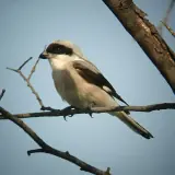 Critically endangered, breeding birdsLesser Grey Shrike
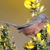 Endangered, breeding birdsDartford Warbler
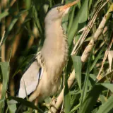 Endangered, breeding birdsLittle Bittern
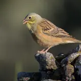 Endangered, breeding birdsOrtolan Bunting
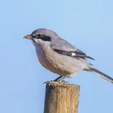 Endangered, breeding birdsSouthern Grey Shrike
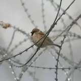 Endangered, breeding birdsEurasian Tree Sparrow
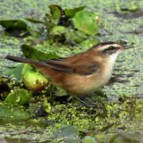 Endangered, breeding birdsMoustached Warbler
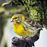 Vulnerable, breeding birdsEuropean Serin
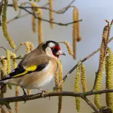 Vulnerable, breeding birdsEurasian Goldfinch
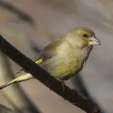 Vulnerable, breeding birdsEuropean Greenfinch
 Vulnerable, breeding birdsCommon Kingfisher
Reptiles
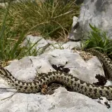
Photos: Wikimedia Commons, each under its own licence (CC BY, CC BY-SA, CC0, public domain). Credit for each photo
In the water's path
Establishments registered today in the communes declared for this flood, taken whole, at their declared address or at the point Géorisques gives. They were not necessarily there on the day of the flood, and the dataset does not say whether they were flooded. An ICPE-classified farm can also be in the SIRENE register: these counts do not add up.
No ICPE-classified livestock farm located in the declared communes
Géorisques · ICPE597 livestock businesses in the SIRENE register based in the declared communes
SIRENE register · Insee139 veterinary practices based in the declared communes
SIRENE register · Insee113 animal protection associations based in the declared communes
National register of associations14 wildlife associations based in the declared communes
National register of associations
Of the 597 livestock businesses in the SIRENE register: 96 cattle, sheep, goat or pig farms, 67 horse farms, 47 poultry farms and 387 farms of other animals.
A wildlife association is an association whose declared purpose in the national register of associations is the preservation of wildlife: the register does not say whether it runs an authorised care centre.
Protected areas in the declared communes
The sites the communes declared for this flood extend over, taken whole, dry sectors included. Natura 2000 and regulatory protection first, then the ZNIEFF, each by its area in these communes. These are not flooded areas: they are not given.
- La plaine et le massif des MauresNatura 2000, Habitats Directive
- Colle du RouetNatura 2000, Birds Directive
- Val d'ArgensNatura 2000, Habitats Directive
- Plaine des MauresNational nature reserve
- Forêt de Palayson - bois du RouetNatura 2000, Habitats Directive
- Plaine des MauresNatura 2000, Birds Directive
- VerdonNatura 2000, Birds Directive
- Rade d'HyèresNatura 2000, Habitats Directive
- Sources et tufs du Haut VarNatura 2000, Habitats Directive
- Iles d'HyèresNatura 2000, Birds Directive
- Gorges de la SiagneNatura 2000, Habitats Directive
- EsterelNatura 2000, Habitats Directive
A marsh can be designated twice under Natura 2000, for its birds and for its habitats: the areas overlap and do not add up.
The declared communes
61 communes declared a natural disaster (flood) for this flood, département by département.
VarSee the 60 communes
Ampus, Bagnols-en-Forêt, Bargemon, Besse-sur-Issole, Cabasse, Callas, Callian, Carcès, Carqueiranne, Châteaudouble, Claviers, Cogolin, Correns, Cotignac, Draguignan, Entrecasteaux, Fayence, Figanières, Flassans-sur-Issole, Flayosc, Fréjus, Gonfaron, Grimaud, Hyères, La Garde-Freinet, La Londe-les-Maures, La Môle, La Motte, Le Cannet-des-Maures, Le Luc, Le Muy, Le Plan-de-la-Tour, Le Thoronet, Les Adrets-de-l'Estérel, Les Arcs, Les Mayons, Lorgues, Mons, Montauroux, Montferrat, Montfort-sur-Argens, Pierrefeu-du-Var, Pignans, Puget-sur-Argens, Ramatuelle, Rayol-Canadel-sur-Mer, Roquebrune-sur-Argens, Saint-Antonin-du-Var, Saint-Paul-en-Forêt, Sainte-Maxime, Salernes, Seillans, Tanneron, Taradeau, Tourrettes, Tourtour, Trans-en-Provence, Vidauban, Villecroze, Vins-sur-Caramy
Alpes-de-Haute-ProvenceSee the commune
Castellane
Download this flood's data
In every file of the dataset, this flood carries the identifier EV-20100615-20100616-83.
Recognised and listed


A project labelled by the French StateNational Resilience Day 2026 (Journée nationale de la résilience)

Registered with GBIFDerived dataset, DOI 10.15468/dd.ta4vkx