
Floods, Indre-et-Loire and 5 other départements, March 2024
4,494 hectares of water detected by radar (Copernicus GFM, Sentinel-1)
801 hectares in Natura 2000 or under regulatory protection
18% of the observed flooded area104 protected animal species recorded within reach in the ten years before the flood


- Communes declared
- 173
- Dates per the orders
- 28 March to 4 April 2024
- Départements
- Indre-et-Loire, Vienne, Indre, Haute-Vienne, Charente and Loir-et-Cher
- Flood type
- river flooding, runoff or mudflow, rising groundwater
- Heaviest rainfall
- 66.1 mm
- in one day (Haute-Vienne, 29 March 2024), LE DORAT station · per Météo-France
- 24 March 2024: 0 mm
- 25 March 2024: 1.4 mm
- 26 March 2024: 12.1 mm
- 27 March 2024: 8.6 mm
- 28 March 2024: 13.5 mm
- 29 March 2024: 66.1 mm
- 30 March 2024: 0 mm
- 31 March 2024: 3.2 mm
- 1 April 2024: 4 mm
88.2 mm from 27 to 29 Mar, up to the wettest day
The flood's dates
- Peak discharge
- 2,360 m³/s
- La Vienne à Nouâtre, on 31 March 2024 · provisional Hub'Eau value, it can be revised
- Extent
- water detected by radar (Copernicus GFM, Sentinel-1)
- 4,494 ha
Protected species recorded within reach
Observations recorded in the ten years before the flood, some known only to within a few kilometres, up to 10 km, when their published position is blurred or given by grid square. They tell which species were reported there, not what became of each animal.
341 species recorded within reach
104 protected animal species among them
93 Birds
4 Reptiles
3 Amphibians
2 Insects
2 Mammals, bats included
The most notable protected animal species
Species with at least three observations (for a bird, three in the months that give it its category, and no bird without a record at the flood's season), the most threatened first, then the most recorded. An observation is a published record: it can count one or several animals, and the same animal can be noted several times. When their published position is imprecise, blurred or given by grid square, they are said to be "within reach or nearby".

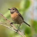
Birds
The observations cover every season: a migrant bird recorded there may have been away on the day of the flood.
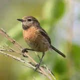
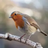
Photos: Wikimedia Commons, each under its own licence (CC BY, CC BY-SA, CC0, public domain). Credit for each photo
In the water's path
Establishments registered today within reach of the flood, at their declared address or at the point Géorisques gives. They were not necessarily there on the day of the flood, and the dataset does not say whether they were flooded. An ICPE-classified farm can also be in the SIRENE register: these counts do not add up.
No ICPE-classified livestock farm located within the flood's reach
Géorisques · ICPENo livestock business in the SIRENE register based within the flood's reach
SIRENE register · InseeNo veterinary practice based within the flood's reach
SIRENE register · InseeNo animal protection association based within the flood's reach
National register of associationsNo wildlife association based within the flood's reach
National register of associations
A wildlife association is an association whose declared purpose in the national register of associations is the preservation of wildlife: the register does not say whether it runs an authorised care centre. Associations are counted at their declared address: an association or a care centre based outside the area can work across all of it.
Protected areas within reach
Area of each site within reach of the flood, and the share of the site it represents. Natura 2000 and regulatory protection first, then the ZNIEFF.
- Basses vallées de la Vienne et de l'IndreNatura 2000, Birds Directive538 ha within reach9.5% of the site
- Plateau de Chabris / La Chapelle - MontmartinNatura 2000, Birds Directive115 ha within reach0.7% of the site
- ChampeigneNatura 2000, Birds Directive87 ha within reach0.6% of the site
- Vallée du Cher et coteaux, forêt de GrosboisFor its birds: Prairies du FouzonNatura 2000, Habitats and Birds Directives24 ha within reach1.4% of the site
- Bois de l'Hospice, étang de Beaufour et environsNatura 2000, Birds Directive19 ha within reach0.5% of the site
- Grande BrenneFor its birds: BrenneNatura 2000, Habitats and Birds Directives10 ha within reachunder 0.1% of the site
- Vallée de l'Anglin et affluentsNatura 2000, Habitats Directive5 ha within reach0.1% of the site
- Bocage du VeronZNIEFF type II (inventoried natural area)80 ha within reach4.9% of the site
- Plateau de champeigne entre Blere et LochesZNIEFF type II (inventoried natural area)67 ha within reach0.7% of the site
- Moyenne vallée de l'IndreZNIEFF type II (inventoried natural area)24 ha within reach0.6% of the site
- Prairies du FouzonZNIEFF type II (inventoried natural area)24 ha within reach1.2% of the site
- Bois de l'Hospice, étang de Beaufour et environsZNIEFF type II (inventoried natural area)19 ha within reach0.5% of the site
A marsh can be designated twice under Natura 2000, for its habitats and for its birds: when both sites carry the same name, or have the same extent and almost the same area here, they share one row. Natura 2000 areas overlap and do not add up. A ZNIEFF is a wildlife inventory, with no regulatory protection.
The declared communes
173 communes declared a natural disaster (flood) for this flood, région by région, then département by département.
Centre-Val de LoireIndre-et-Loire, Indre, Loir-et-Cher
Indre-et-LoireSee the 50 communes
Abilly, Anché, Antogny-le-Tillac, Azay-le-Rideau, Azay-sur-Indre, Barrou, Beaumont-en-Véron, Beaumont-Village, Bossay-sur-Claise, Boussay, Candes-Saint-Martin, Chambon, Chaumussay, Chédigny, Chemillé-sur-Indrois, Chinon, Courçay, Cravant-les-Côteaux, Crouzilles, Descartes, Genillé, L'Île-Bouchard, La Celle-Saint-Avant, La Guerche, Le Petit-Pressigny, Loché-sur-Indrois, Marcilly-sur-Vienne, Montrésor, Nouans-les-Fontaines, Nouâtre, Panzoult, Parçay-sur-Vienne, Ports-sur-Vienne, Pouzay, Preuilly-sur-Claise, Pussigny, Rilly-sur-Vienne, Rivarennes, Rivière, Saint-Germain-sur-Vienne, Saint-Quentin-sur-Indrois, Savigny-en-Véron, Sazilly, Theneuil, Trogues, Truyes, Veigné, Villedômain, Villeloin-Coulangé, Yzeures-sur-Creuse
IndreSee the 44 communes
Argenton-sur-Creuse, Argy, Azay-le-Ferron, Bélâbre, Buzançais, Chaillac, Chalais, Chasseneuil, Chazelet, Chitray, Clion, Concremiers, Dunet, Écueillé, Éguzon-Chantôme, Ingrandes, Jeu-Maloches, Langé, Le Blanc, Le Pont-Chrétien-Chabenet, Lignac, Luçay-le-Mâle, Lye, Martizay, Mauvières, Menetou-sur-Nahon, Mérigny, Mézières-en-Brenne, Neuillay-les-Bois, Oulches, Paulnay, Pouligny-Saint-Pierre, Prissac, Sacierges-Saint-Martin, Saint-Gaultier, Saint-Genou, Saint-Hilaire-sur-Benaize, Val-Fouzon, Valençay, Vendœuvres, Veuil, Vicq-sur-Nahon, Villegouin, Villentrois-Faverolles-en-Berry
Loir-et-CherSee the 2 communes
Châteauvieux, Couffy
Nouvelle-AquitaineVienne, Haute-Vienne, Charente
VienneSee the 47 communes
Angles-sur-l'Anglin, Antigny, Antran, Availles-Limouzine, Bonnes, Bonneuil-Matours, Brigueil-le-Chantre, Buxeuil, Châtellerault, Chauvigny, Civaux, Coulonges-les-Hérolles, Dangé-Saint-Romain, Gouex, Jouhet, Journet, La Bussière, La Chapelle-Moulière, La Roche-Posay, La Trimouille, Lathus-Saint-Rémy, Les Ormes, Lésigny, Leugny, Liglet, Lussac-les-Châteaux, Mairé, Mazerolles, Millac, Montmorillon, Moussac, Nalliers, Persac, Pindray, Plaisance, Port-de-Piles, Queaux, Saint-Germain, Saint-Pierre-de-Maillé, Saint-Rémy-sur-Creuse, Saint-Savin, Saulgé, Thollet, Valdivienne, Vaux-sur-Vienne, Vicq-sur-Gartempe, Vouneuil-sur-Vienne
Haute-VienneSee the 24 communes
Aixe-sur-Vienne, Bellac, Berneuil, Bosmie-l'Aiguille, Chamboret, Condat-sur-Vienne, Dinsac, Folles, Isle, La Croix-sur-Gartempe, Le Chalard, Le Dorat, Le Vigen, Magnac-Laval, Oradour-Saint-Genest, Peyrat-de-Bellac, Rochechouart, Saint-Junien, Saint-Martin-de-Jussac, Saint-Martin-le-Mault, Saint-Priest-sous-Aixe, Solignac, Val-d'Oire-et-Gartempe, Verneuil-Moustiers
CharenteSee the 6 communes
Chabanais, Confolens, Étagnac, Exideuil-sur-Vienne, Lessac, Manot
Download this flood's data
In every file of the dataset, this flood carries the identifier EV-20240329-20240404-37. Its dates were frozen when the identifier was created and differ here from the flood's.
Recognised and listed


A project labelled by the French StateNational Resilience Day 2026 (Journée nationale de la résilience)

Registered with GBIFDerived dataset, DOI 10.15468/dd.ta4vkx