
Floods, Pas-de-Calais and 5 other départements, May 2016
2,167 hectares of water detected by radar (Copernicus GFM, Sentinel-1)
33 protected animal species recorded within reach in the ten years before the flood

- Communes declared
- 243
- Dates per the orders
- 27 May to 11 June 2016
- Départements
- Pas-de-Calais, Nord, Somme, Oise, Aisne and Seine-Maritime
- Flood type
- river flooding, runoff or mudflow
- Heaviest rainfall
- 92.6 mm
- in one day (Pas-de-Calais, 7 June 2016), MONDICOURT station · per Météo-France
- 2 June 2016: 0.9 mm
- 3 June 2016: 0.3 mm
- 4 June 2016: 1.4 mm
- 5 June 2016: 1.1 mm
- 6 June 2016: 0 mm
- 7 June 2016: 92.6 mm
- 8 June 2016: 0.3 mm
- 9 June 2016: 0 mm
- 10 June 2016: 0 mm
93.7 mm from 5 to 7 Jun, up to the wettest day
The flood's dates
- Peak discharge
- 38 m³/s
- La Lawe à Houdain, on 7 June 2016 · per Hub'Eau
- Extent
- water detected by radar (Copernicus GFM, Sentinel-1)
- 2,167 ha
Protected species recorded within reach
Observations recorded in the ten years before the flood, some known only to within a few kilometres, up to 10 km, when their published position is blurred or given by grid square. They tell which species were reported there, not what became of each animal.
419 species recorded within reach
33 protected animal species among them
29 Birds
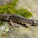
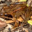
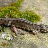
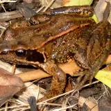
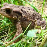
4 Amphibians
The most notable protected animal species
Species with at least three observations (for a bird, three in the months that give it its category, and no bird without a record at the flood's season), the most threatened first, then the most recorded. An observation is a published record: it can count one or several animals, and the same animal can be noted several times. When their published position is imprecise, blurred or given by grid square, they are said to be "within reach or nearby".
Amphibians
Birds
The observations cover every season: a migrant bird recorded there may have been away on the day of the flood.

Photos: Wikimedia Commons, each under its own licence (CC BY, CC BY-SA, CC0, public domain). Credit for each photo
In the water's path
Establishments registered today within reach of the flood, at their declared address or at the point Géorisques gives. They were not necessarily there on the day of the flood, and the dataset does not say whether they were flooded. An ICPE-classified farm can also be in the SIRENE register: these counts do not add up.
No ICPE-classified livestock farm located within the flood's reach
Géorisques · ICPENo livestock business in the SIRENE register based within the flood's reach
SIRENE register · InseeNo veterinary practice based within the flood's reach
SIRENE register · InseeNo animal protection association based within the flood's reach
National register of associationsNo wildlife association based within the flood's reach
National register of associations
A wildlife association is an association whose declared purpose in the national register of associations is the preservation of wildlife: the register does not say whether it runs an authorised care centre. Associations are counted at their declared address: an association or a care centre based outside the area can work across all of it.
Protected areas within reach
Area of each site within reach of the flood, and the share of the site it represents. Natura 2000 and regulatory protection first, then the ZNIEFF.
- Haute vallée de l'Escaut en amont de Crèvecoeur-sur-l'EscautZNIEFF type I (inventoried natural area)10 ha within reach0.5% of the site
- La Plaine alluviale de la Scarpe entre Flines-lez-Râches et la confluence avec l’EscautZNIEFF type II (inventoried natural area)6 ha within reachunder 0.1% of the site
- Marais de Beuvry, Cuinchy et FestubertZNIEFF type I (inventoried natural area)3 ha within reach0.3% of the site
- Forêt domaniale de Vimy, coteau boisé de Farbus et bois de l’AbîmeZNIEFF type I (inventoried natural area)1 ha within reach0.1% of the site
A ZNIEFF is a wildlife inventory, with no regulatory protection.
The declared communes
243 communes declared a natural disaster (flood) for this flood, région by région, then département by département.
Hauts-de-FrancePas-de-Calais, Nord, Somme, Oise, Aisne
Pas-de-CalaisSee the 124 communes
Ablain-Saint-Nazaire, Agnières, Aix-Noulette, Alette, Allouagne, Angres, Annay, Annequin, Annezin, Anvin, Anzin-Saint-Aubin, Auchy-les-Mines, Avion, Bajus, Barlin, Beaudricourt, Berlencourt-le-Cauroy, Béthune, Beugin, Beuvry, Bours, Bourthes, Bouvigny-Boyeffles, Bruay-la-Buissière, Bully-les-Mines, Burbure, Busnes, Calonne-Ricouart, Cambligneul, Cambrin, Campagne-lès-Boulonnais, Carency, Caucourt, Coupelle-Vieille, Cuinchy, Diéval, Divion, Doudeauville, Douvrin, Eps, Essars, Estrée-Blanche, Estrée-Wamin, Famechon, Festubert, Fleurbaix, Fouquereuil, Fouquières-lès-Béthune, Fresnicourt-le-Dolmen, Gauchin-Légal, Givenchy-en-Gohelle, Givenchy-lès-la-Bassée, Gonnehem, Gosnay, Grenay, Haisnes, Hénin-Beaumont, Hermin, Hersin-Coupigny, Hinges, Houchin, Houdain, Hulluch, Isbergues, La Comté, La Couture, La Thieuloye, Labeuvrière, Labourse, Lapugnoy, Laventie, Lestrem, Liévin, Lillers, Linghem, Locon, Loison-sous-Lens, Longfossé, Lorgies, Lugy, Magnicourt-en-Comte, Magnicourt-sur-Canche, Maisnil-lès-Ruitz, Marest, Marœuil, Mazingarbe, Monchy-Cayeux, Mont-Saint-Éloi, Neuve-Chapelle, Neuville-Saint-Vaast, Norrent-Fontes, Noyelles-lès-Vermelles, Ostreville, Ourton, Parenty, Pas-en-Artois, Preures, Rebreuve-Ranchicourt, Richebourg, Robecq, Roclincourt, Roëllecourt, Ruitz, Sailly-au-Bois, Sailly-Labourse, Sailly-sur-la-Lys, Saint-Amand, Samer, Senlis, Servins, Souchez, Thiembronne, Thièvres, Vaudricourt, Vendin-le-Vieil, Vermelles, Verquigneul, Verquin, Vieille-Chapelle, Villers-au-Bois, Violaines, Warlincourt-lès-Pas, Wingles, Zoteux
NordSee the 82 communes
Anstaing, Arnèke, Aubers, Auby, Auchy-lez-Orchies, Bachy, Bailleul, Baisieux, Banteux, Bersée, Beuvry-la-Forêt, Boeschepe, Bondues, Bourghelles, Bouvignies, Bouvines, Bugnicourt, Camphin-en-Pévèle, Cappelle-en-Pévèle, Cobrieux, Coutiches, Crèvecœur-sur-l'Escaut, Cysoing, Dehéries, Dimechaux, Douai, Emmerin, Ennetières-en-Weppes, Ennevelin, Faumont, Feignies, Flines-lez-Raches, Forest-sur-Marque, Fretin, Genech, Godewaersvelde, Gondecourt, Gruson, Hordain, Houplin-Ancoisne, La Bassée, La Gorgue, Lambersart, Le Doulieu, Lecelles, Linselles, Lompret, Louvil, Mairieux, Marchiennes, Marcq-en-Barœul, Marquette-lez-Lille, Merris, Mons-en-Pévèle, Mouchin, Nomain, Noordpeene, Orchies, Pérenchies, Prémesques, Quesnoy-sur-Deûle, Râches, Raimbeaucourt, Roncq, Roost-Warendin, Rosult, Rumegies, Sainghin-en-Mélantois, Saint-André-lez-Lille, Saint-Python, Sin-le-Noble, Steenwerck, Templeuve-en-Pévèle, Tourcoing, Verlinghem, Villers-Outréaux, Wambrechies, Wannehain, Wasquehal, Wattrelos, Wavrechain-sous-Faulx, Waziers
SommeSee the 29 communes
Authieule, Barly, Bayencourt, Bernâtre, Berteaucourt-les-Dames, Canaples, Candas, Coigneux, Courtemanche, Doullens, Fieffes-Montrelet, Gézaincourt, Grouches-Luchuel, Guizancourt, Halloy-lès-Pernois, Havernas, Hem-Hardinval, Humbercourt, Louvencourt, Lucheux, Mézerolles, Monchy-Lagache, Naours, Occoches, Outrebois, Pernois, Saint-Léger-lès-Authie, Thièvres, Vignacourt
OiseSee the 6 communes
Campeaux, Cernoy, Formerie, Grandvillers-aux-Bois, Moliens, Vignemont
AisneSee the commune
Buironfosse
NormandieSeine-Maritime
Seine-MaritimeSee the commune
Grumesnil
Download this flood's data
In every file of the dataset, this flood carries the identifier EV-20160607-20160607-59-02135. Its dates were frozen when the identifier was created and differ here from the flood's.
Recognised and listed


A project labelled by the French StateNational Resilience Day 2026 (Journée nationale de la résilience)

Registered with GBIFDerived dataset, DOI 10.15468/dd.ta4vkx